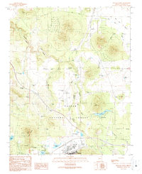
1989 Map of Williams North
USGS Topo · Published 1990About this map
Kaibab National Forest dominates the southern landscape of this northern Arizona survey, surrounding the northern edge of Williams, which includes an early Golf Course and several Athletic Fields. The map documents a critical transition point for water management in the high desert, featuring a complex network of reservoirs and tanks such as Kaibab Lake, Cataract Lake, and Gonzalez Lake. These water sources, alongside the deep incision of Cataract Creek Canyon, reveal the historical reliance on catchment systems for both ranching and municipal needs in Coconino County. Transportation and infrastructure are centered around Airport Road leading to the Williams Municipal Airport and its Airway Beacon, while the northern reaches show the open-range character of the land at Pronghorn Ranch. This record is particularly valuable for tracing the growth of the corporate boundary around Williams and the distribution of various Cinder Pit operations and gravel excavations that supported local development.
Find a feature on this map
50 named features on this map. Tap any name to fly to it.
Don’t see what you’re looking for? This feature index may not catch every label — zoom into the map to look around manually.
Map Details
Editions of this 1989 Williams North Map
2 editions found
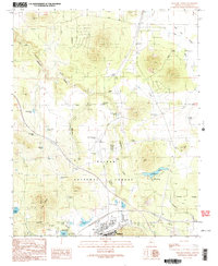
Other maps of this area

1886 · Chino
USGS Topo · 1:250,000

1891 · Chino
USGS Topo · 1:250,000

1922 · Williams
USGS Topo · 1:125,000

1947 · Ash Fork
USGS Topo · 1:62,500

1948 · Ash Fork
USGS Topo · 1:63,360

1948 · Williams
USGS Topo · 1:250,000

1949 · Ash Fork
USGS Topo · 1:62,500

1954 · Williams
USGS Topo · 1:250,000

1956 · Williams
USGS Topo · 1:250,000

1960 · Williams
USGS Topo · 1:250,000