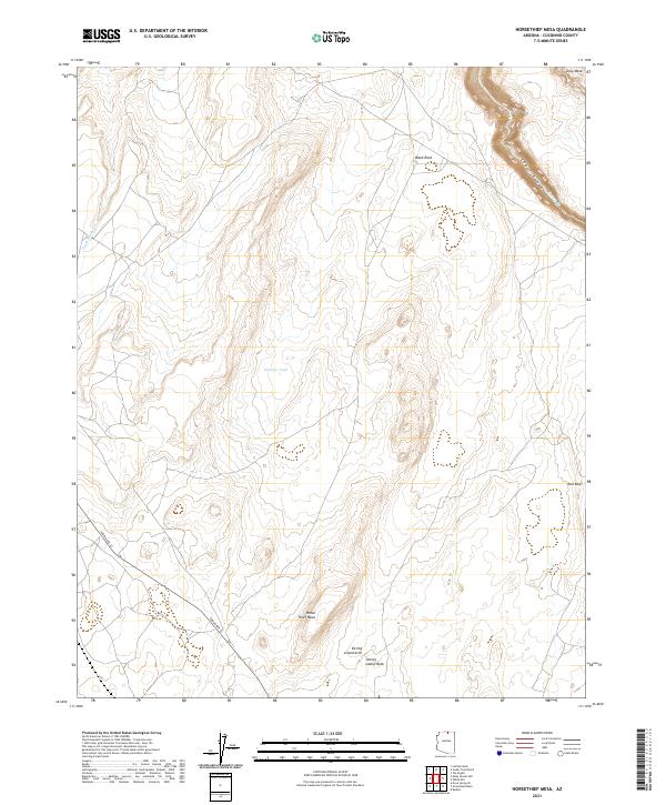
2021 Map of Horsethief Mesa
USGS Topo · Published 2021About this map
Horse Thief Mesa and the surrounding high desert of Coconino County are defined by a complex network of canyons and mesas typical of the Arizona Plateau. This 2021 study reveals a landscape shaped by drainage systems like Kaibito Creek and Pedah Wash, which carve through the sandstone formations. The area is characterized by distinctive geological landmarks, notably Sitting Lizard Rock and the nearby Sitting Lizard Arch, providing precise locations for researchers of Southwestern geology and landforms. Access is primarily limited to Indian Rte 22, which cuts across the southwestern corner of the quadrangle. Beyond the roads, the presence of Circular Tank suggests the vital importance of water management in this arid environment, while features like Black Rock and Red Bluff serve as significant navigational waypoints across the open terrain.
Find a feature on this map
17 named features on this map. Tap any name to fly to it.
Don’t see what you’re looking for? This feature index may not catch every label — zoom into the map to look around manually.
Map Details
Editions of this 2021 Horsethief Mesa Map
This is the sole edition of this map. No revisions or reprints were ever made.
Other maps of this area

1886 · Echo Cliffs
USGS Topo · 1:250,000

1891 · Echo Cliffs
USGS Topo · 1:250,000

1954 · Leche-E Rock
USGS Topo · 1:62,500

1954 · Navajo Creek
USGS Topo · 1:62,500

1956 · Marble Canyon
USGS Topo · 1:250,000

1959 · Marble Canyon
USGS Topo · 1:250,000

1961 · Marble Canyon
USGS Topo · 1:250,000
1981 · Horsethief Mesa
USGS Topo · 1:24,000
1981 · Kaibito
USGS Topo · 1:24,000
1982 · White Hill
USGS Topo · 1:24,000