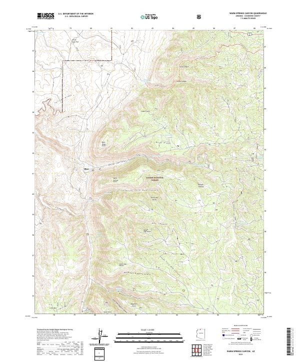
2021 Map of Warm Springs Canyon
USGS Topo · Published 2021About this map
Ryan sits along the western edge of this territory, overlooking a complex network of high plateaus and deep drainages within the Kaibab National Forest. The landscape is defined by the massive Kaibab Plateau and the erosion of the Warm Springs Canyon system. Water sources are critical markers in this arid high-elevation environment, with numerous natural springs and man-made improvements like Warm Springs, Moquitch Spring, and Jacob Canyon Tank scattered across the ridges. These water points often dictated the movement of livestock and early travelers through the forest.
Find a feature on this map
44 named features on this map. Tap any name to fly to it.
Don’t see what you’re looking for? This feature index may not catch every label — zoom into the map to look around manually.
Map Details
Editions of this 2021 Warm Springs Canyon Map
This is the sole edition of this map. No revisions or reprints were ever made.
Other maps of this area

1886 · Kaibab
USGS Topo · 1:250,000

1936 · Jacobs Lake
USGS Topo · 1:48,000

1940 · Jacob Lake
USGS Topo · 1:62,500

1953 · Jacobs Lake
USGS Topo · 1:62,500

1953 · Grand Canyon
USGS Topo · 1:250,000

1957 · Grand Canyon
USGS Topo · 1:250,000

1957 · Shinarump SE
USGS Topo · 1:24,000
1957 · House Rock Spring SW
USGS Topo · 1:24,000

1957 · Shinarump SW
USGS Topo · 1:24,000
1957 · House Rock Spring
USGS Topo · 1:62,500