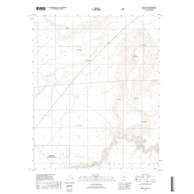
2018 Map of Sunset Pass
USGS Topo · Published 2018About this map
Sunset Pass serves as the focal point of this high-desert landscape in Coconino National Forest. The terrain is defined by dramatic mesas and ridges, including West Sunset Mtn, East Sunset Mtn, and the distinctive Table Mtn. This area shows a complex network of water management features essential for life in the arid Arizona interior, where numerous tanks like Fisher Tank and Chaucey Tank are strategically positioned to capture runoff from the drainages of Jacks Canyon and Limestone Wash. To the south, the deep incision of Clear Cr and the unique Echinique Draw showcase the erosional power that has shaped the Coconino plateau. The presence of features such as Dick Hart Tank suggests a history of cattle ranching and land use tied to these isolated water sources.
Find a feature on this map
30 named features on this map. Tap any name to fly to it.
Don’t see what you’re looking for? This feature index may not catch every label — zoom into the map to look around manually.
Map Details
Editions of this 2018 Sunset Pass Map
This is the sole edition of this map. No revisions or reprints were ever made.
Other maps of this area

1886 · Holbrook
USGS Topo · 1:250,000

1887 · Verde
USGS Topo · 1:250,000

1892 · Verde
USGS Topo · 1:250,000

1893 · Holbrook
USGS Topo · 1:250,000

1954 · Holbrook
USGS Topo · 1:250,000

1955 · Sunset Knoll 2 SW
USGS Topo · 1:24,000
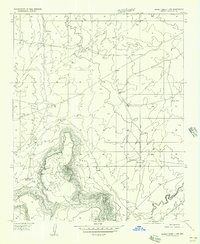
1955 · Sunset Knoll 2 NW
USGS Topo · 1:24,000

1955 · Sunset Knoll 2 SE
USGS Topo · 1:24,000

1955 · Sunset Pass
USGS Topo · 1:62,500

1957 · Holbrook
USGS Topo · 1:250,000