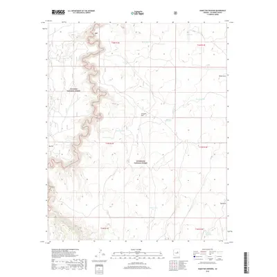
2018 Map of Hamilton Crossing
USGS Topo · Published 2018About this map
The Coconino National Forest and Sitgreaves National Forest meet in this landscape of high plateaus and deep drainages. The rugged topography is defined by the winding course of Clear Creek, which carves a narrow, serpentine canyon across the northern and western sections of the map. This area represents a critical point of confluence for forest management and natural water resources, where local water management is evidenced by dozens of named catchment features such as Echinique Tank, O'Haco Tank, and Surprise Tank.
Find a feature on this map
29 named features on this map. Tap any name to fly to it.
Don’t see what you’re looking for? This feature index may not catch every label — zoom into the map to look around manually.
Map Details
Editions of this 2018 Hamilton Crossing Map
This is the sole edition of this map. No revisions or reprints were ever made.
Other maps of this area

1886 · Holbrook
USGS Topo · 1:250,000

1887 · Verde
USGS Topo · 1:250,000

1892 · Verde
USGS Topo · 1:250,000

1893 · Holbrook
USGS Topo · 1:250,000

1954 · Holbrook
USGS Topo · 1:250,000

1955 · Sunset Knoll 2 SW
USGS Topo · 1:24,000

1955 · Sunset Knoll 2 SE
USGS Topo · 1:24,000

1955 · Sunset Pass
USGS Topo · 1:62,500

1957 · Holbrook
USGS Topo · 1:250,000

1958 · Holbrook
USGS Topo · 1:250,000