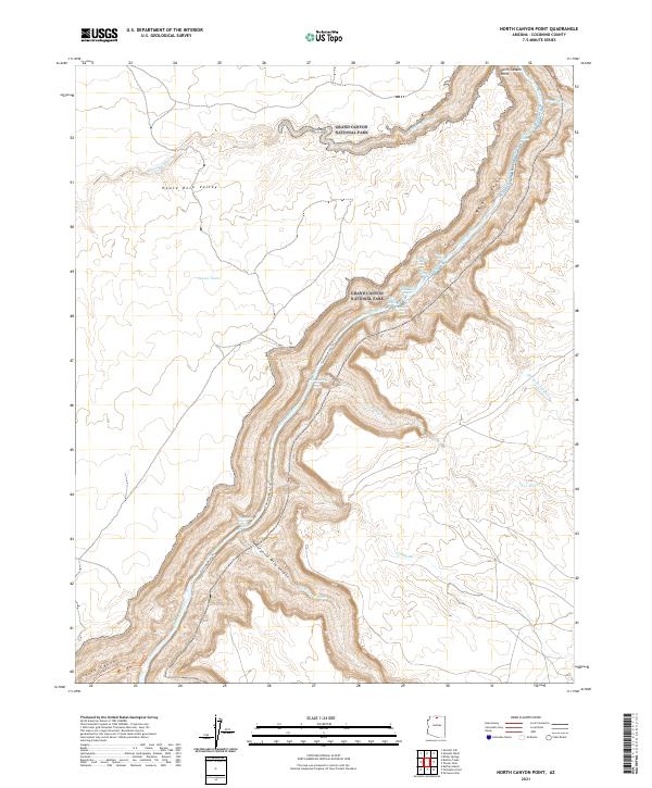
2021 Map of North Canyon Point
USGS Topo · Published 2021About this map
Grand Canyon National Park occupies the central corridor of this survey, where the Colorado River carves deeply through the landscape of northern Arizona. The topography is defined by the sheer verticality of Marble Canyon, a stretch of the river system punctuated by treacherous white water such as Hansbrough-Richards Rapid and the Twenty-four and One-Half Mile Rapids. To the west, the relatively level expanse of House Rock Valley contrasts sharply with the canyon depths, providing essential stock water at sites like Jensen Tanks. The map reveals the intricate network of drainage systems feeding into the main artery, including Twenty-nine Mile Canyon and N Canyon Wash. This area serves as a critical junction for remote backcountry travel, evidenced by the Colorado River Trl and the South Canyon Trl which provide limited access to the canyon floor and the high overlook at North Canyon Point.
Find a feature on this map
27 named features on this map. Tap any name to fly to it.
Don’t see what you’re looking for? This feature index may not catch every label — zoom into the map to look around manually.
Map Details
Editions of this 2021 North Canyon Point Map
This is the sole edition of this map. No revisions or reprints were ever made.
Other maps of this area

1886 · Echo Cliffs
USGS Topo · 1:250,000

1891 · Echo Cliffs
USGS Topo · 1:250,000

1954 · Emmett Wash NE
USGS Topo · 1:24,000

1954 · Emmett Wash NW
USGS Topo · 1:24,000

1954 · Nankoweap
USGS Topo · 1:62,500

1954 · Tanner Wash
USGS Topo · 1:62,500

1954 · Emmett Wash
USGS Topo · 1:62,500

1954 · Shinumo Altar
USGS Topo · 1:62,500

1956 · Marble Canyon
USGS Topo · 1:250,000

1959 · Marble Canyon
USGS Topo · 1:250,000