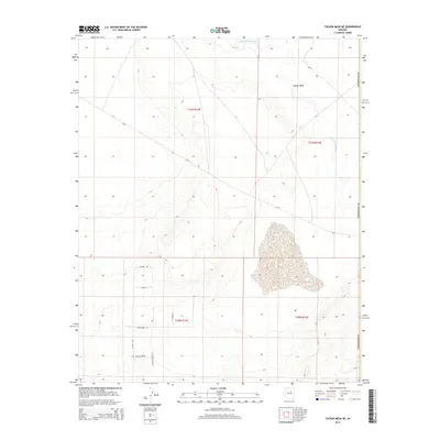
2014 Map of Tucker Mesa NE
USGS Topo · Published 2014About this map
The Little Colorado River winds through the northeastern corner of this Coconino County landscape, marking a critical hydrological artery in an otherwise arid expanse. Much of the terrain is defined by the broad elevated form of Tucker Mesa and the drainage of Coyote Wash, showing a topography shaped by intermittent water flow and significant elevation changes. The southern portion of the quadrangle reveals a growing network of rural access routes, including N Hunt Rd, Robanser Rd, and Little Butte Rd. These roads, along with smaller arteries like N Clark Ln and Hunt Ln, trace the modern settlement patterns and land divisions within the desert. This 2014 survey documents the intersection of natural geographic features and the expanding human footprint on the land.
Find a feature on this map
16 named features on this map. Tap any name to fly to it.
Don’t see what you’re looking for? This feature index may not catch every label — zoom into the map to look around manually.
Map Details
Editions of this 2014 Tucker Mesa NE Map
This is the sole edition of this map. No revisions or reprints were ever made.
Other maps of this area

1883 · Tusayan
USGS Topo · 1:250,000

1886 · Tusayan
USGS Topo · 1:250,000

1947 · Flagstaff
USGS Topo · 1:250,000

1954 · Winslow
USGS Topo · 1:62,500

1954 · Winslow 4 NW
USGS Topo · 1:24,000

1954 · Winslow 4 SW
USGS Topo · 1:24,000

1954 · Flagstaff
USGS Topo · 1:250,000

1955 · Winslow 2 SW
USGS Topo · 1:24,000

1955 · Leupp
USGS Topo · 1:62,500

1957 · Winslow 1 SW
USGS Topo · 1:24,000