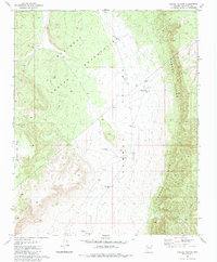
1981 Map of Crater Canyon
USGS Topo · Published 1984About this map
The Hualapai Indian Reservation and the dramatic topography of the Aubrey Cliffs define this high-desert landscape in northern Arizona. This 1981 survey documents the eastern edge of the reservation where it meets the broad expanse of Aubrey Valley. The settlement pattern here is sparse, characterized by isolated outposts and seasonal water sources essential for cattle ranching. Small landmarks like Stonys Cabin, located near Indian Well, suggest the remote and functional nature of human presence in the region during the late 20th century.
Find a feature on this map
21 named features on this map. Tap any name to fly to it.
Don’t see what you’re looking for? This feature index may not catch every label — zoom into the map to look around manually.
Map Details
Editions of this 1981 Crater Canyon Map
2 editions found
Other maps of this area

1886 · Diamond Creek
USGS Topo · 1:250,000

1886 · Chino
USGS Topo · 1:250,000

1891 · Chino
USGS Topo · 1:250,000

1892 · Diamond Creek
USGS Topo · 1:250,000

1948 · Williams
USGS Topo · 1:250,000

1954 · Williams
USGS Topo · 1:250,000

1956 · Williams
USGS Topo · 1:250,000

1960 · Williams
USGS Topo · 1:250,000

1961 · Williams
USGS Topo · 1:250,000
1967 · Frazier Wells
USGS Topo · 1:24,000