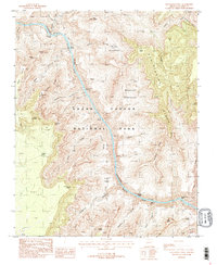
1988 Map of Havasupai Point
USGS Topo · Published 1988About this map
Colorado River currents carve through Granite Gorge in this detailed 1980s look at the central portion of Grand Canyon National Park. The survey highlights a series of formidable whitewater features including Shinumo Rapids, Bass Rapids, and Serpentine Rapids, which define the river's path through the deep canyon floor. High above the water, the topography rises to distinctive promontories such as Havasupai Point and Walapai Point, while the Signal Hill Lookout Tower stands as a landmark of park oversight. The map provides clear evidence of early backcountry travel routes, specifically the Bass Trail descending toward the river and the long-distance Tonto Trail contouring above the gorge. Large geological features like the Hotauta Amphitheater and Monadnock Amphitheater illustrate the massive scale of erosion in the Sagittarius Ridge area.
Find a feature on this map
47 named features on this map. Tap any name to fly to it.
Don’t see what you’re looking for? This feature index may not catch every label — zoom into the map to look around manually.
Map Details
Editions of this 1988 Havasupai Point Map
3 editions found
Other maps of this area

1886 · Kaibab
USGS Topo · 1:250,000

1903 · Bright Angel
USGS Topo · 1:48,000

1906 · Bright Angel
USGS Topo · 1:48,000

1953 · Grand Canyon
USGS Topo · 1:250,000

1957 · Grand Canyon
USGS Topo · 1:250,000

1958 · Grand Canyon
USGS Topo · 1:250,000

1960 · Grand Canyon
USGS Topo · 1:250,000

1962 · Bright Angel
USGS Topo · 1:48,000

1962 · De Motte Park
USGS Topo · 1:62,500

1962 · Havasupai Point
USGS Topo · 1:62,500