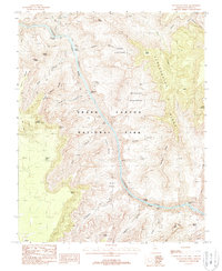
1988 Map of Havasupai Point
USGS Topo · Published 1988About this map
Grand Canyon National Park occupies the core of this 1980s topographic study, documenting the complex corridor of the Colorado River as it winds through the Granite Gorge. The map details a landscape of dramatic vertical relief where features like the Le Conte Plateau and Shaler Plateau overlook a network of deep drainages including Serpentine Canyon and Sapphire Canyon.
Find a feature on this map
48 named features on this map. Tap any name to fly to it.
Don’t see what you’re looking for? This feature index may not catch every label — zoom into the map to look around manually.
Map Details
Editions of this 1988 Havasupai Point Map
3 editions found
Other maps of this area

1886 · Kaibab
USGS Topo · 1:250,000

1903 · Bright Angel
USGS Topo · 1:48,000

1906 · Bright Angel
USGS Topo · 1:48,000

1953 · Grand Canyon
USGS Topo · 1:250,000

1957 · Grand Canyon
USGS Topo · 1:250,000

1958 · Grand Canyon
USGS Topo · 1:250,000

1960 · Grand Canyon
USGS Topo · 1:250,000

1962 · Bright Angel
USGS Topo · 1:48,000

1962 · De Motte Park
USGS Topo · 1:62,500

1962 · Havasupai Point
USGS Topo · 1:62,500