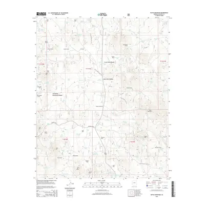
2014 Map of Hutch Mountain
USGS Topo · Published 2014About this map
Coconino National Forest dominates this high-altitude landscape, characterized by a series of open parks and deep canyons. The terrain transitions from the heights of Hutch Mountain and Mahan Mtn down through Kinnikinick Canyon and Fulton Canyon. The presence of Coyote Basin Ranch and Allan Lake Landing suggests a history of localized ranching and forest management, while numerous tanks such as Logger Tank and Southeast Tank emphasize the critical importance of water management in this arid environment. The Arizona National Scenic Trail winds through the central portion of the sheet, connecting these features across a landscape defined by significant topographic landmarks like Jackson Butte and Bill Back Butte. Evidence of resource extraction is visible through the Borrow Pit Number One-Tank and Borrow Pit Number Two-Tank, which likely supported the maintenance of forest roads such as Stoneman Lake Rd.
Find a feature on this map
109 named features on this map. Tap any name to fly to it.
Don’t see what you’re looking for? This feature index may not catch every label — zoom into the map to look around manually.
Map Details
Editions of this 2014 Hutch Mountain Map
This is the sole edition of this map. No revisions or reprints were ever made.
Other maps of this area

1887 · Verde
USGS Topo · 1:250,000

1892 · Verde
USGS Topo · 1:250,000

1923 · Camp Verde
USGS Topo · 1:125,000

1932 · Camp Verde
USGS Topo · 1:125,000

1936 · Camp Verde
USGS Topo · 1:125,000

1954 · Holbrook
USGS Topo · 1:250,000

1957 · Holbrook
USGS Topo · 1:250,000

1958 · Holbrook
USGS Topo · 1:250,000

1960 · Holbrook
USGS Topo · 1:250,000
1965 · Hutch Mtn.
USGS Topo · 1:24,000