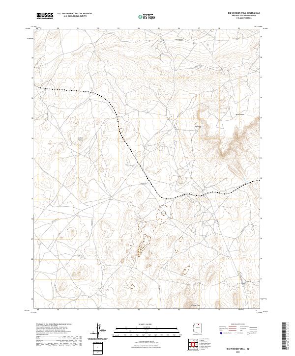
2021 Map of Big Whisker Well
USGS Topo · Published 2021About this map
Big Whisker Well sits within a wide high-desert landscape in Coconino County, serving as a primary water reference point for the surrounding cattle country and ranching operations. The terrain is defined by the broad elevation of the Kaibito Plateau, which rises toward the prominent relief of White Mesa in the northeast and the isolated height of Wildcat Peak to the south. This area is characterized by an extensive network of local transit corridors, including Indian Rte 21, Indian Rte 215, and Co Rd 211, which facilitate movement across the tribal lands and grazing districts. The 2021 survey demonstrates the persistent importance of named wells and water sources in this arid environment, providing a detailed look at the section lines and township boundaries that organize the territory across the Plateau.
Find a feature on this map
18 named features on this map. Tap any name to fly to it.
Don’t see what you’re looking for? This feature index may not catch every label — zoom into the map to look around manually.
Map Details
Editions of this 2021 Big Whisker Well Map
This is the sole edition of this map. No revisions or reprints were ever made.
Other maps of this area

1883 · Marsh Pass
USGS Topo · 1:250,000

1886 · Echo Cliffs
USGS Topo · 1:250,000

1891 · Echo Cliffs
USGS Topo · 1:250,000

1892 · Marsh Pass
USGS Topo · 1:250,000

1956 · Marble Canyon
USGS Topo · 1:250,000

1959 · Marble Canyon
USGS Topo · 1:250,000

1961 · Marble Canyon
USGS Topo · 1:250,000

1970 · Square Butte
USGS Topo · 1:24,000
1970 · Tonalea
USGS Topo · 1:24,000
1970 · White Mesa Arch
USGS Topo · 1:24,000