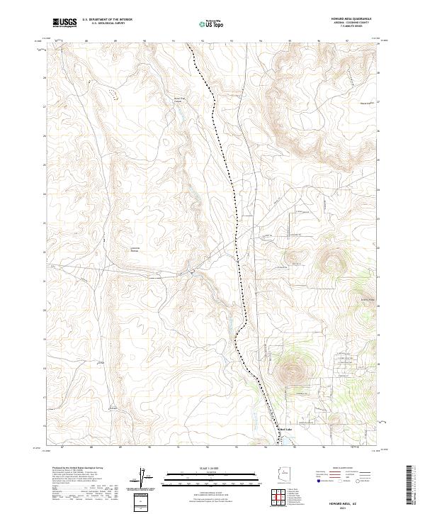
2021 Map of Howard Mesa
USGS Topo · Published 2021About this map
Red Lake and the drainage of Red Lake Wash anchor this part of the Coconino Plateau in northern Arizona. The landscape is characterized by broad topographic features such as Howard Mesa to the northeast and Vickery Ridge to the southeast, separated by the wide expansive floor of LO Flat and LO Draw. The map documents a contemporary rural settlement pattern centered on the small community of Red Lake, where a grid of named local roads and lanes like Pony Express Dr and Bella Vis Lp branches out from the main transit corridors. These residential developments contrast with the more remote reaches of Horse-Trap Canyon, reflecting the 21st-century evolution of the area as it transitions from open range toward more defined rural homesteads and access roads.
Find a feature on this map
41 named features on this map. Tap any name to fly to it.
Don’t see what you’re looking for? This feature index may not catch every label — zoom into the map to look around manually.
Map Details
Editions of this 2021 Howard Mesa Map
This is the sole edition of this map. No revisions or reprints were ever made.
Other maps of this area

1886 · Chino
USGS Topo · 1:250,000

1891 · Chino
USGS Topo · 1:250,000

1922 · Williams
USGS Topo · 1:125,000

1948 · Williams
USGS Topo · 1:250,000

1954 · Williams
USGS Topo · 1:250,000

1956 · Williams
USGS Topo · 1:250,000

1960 · Williams
USGS Topo · 1:250,000
1960 · Williams
USGS Topo · 1:62,500

1961 · Williams
USGS Topo · 1:250,000

1962 · Valle
USGS Topo · 1:62,500