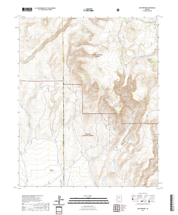
2021 Map of Matterhorn
USGS Topo · Published 2021About this map
Kaibab National Forest and Prescott National Forest meet in this landscape defined by high mesas and seasonal water basins. The rugged geography of the Coconino and Yavapai county line is marked by distinctive formations like the Matterhorn and Wild Steer Mesa. This area relies on a network of stock tanks such as Tule Tank and Winter Camp Tank to manage the arid environment of Tule Basin and Hell Canyon.
Find a feature on this map
40 named features on this map. Tap any name to fly to it.
Don’t see what you’re looking for? This feature index may not catch every label — zoom into the map to look around manually.
Map Details
Editions of this 2021 Matterhorn Map
This is the sole edition of this map. No revisions or reprints were ever made.
Other maps of this area

1886 · Chino
USGS Topo · 1:250,000

1887 · Prescott
USGS Topo · 1:250,000

1891 · Chino
USGS Topo · 1:250,000

1892 · Prescott
USGS Topo · 1:250,000

1905 · Jerome
USGS Topo · 1:125,000

1922 · Williams
USGS Topo · 1:125,000

1944 · Clarkdale
USGS Topo · 1:48,000

1947 · Ash Fork
USGS Topo · 1:62,500

1947 · Paulden
USGS Topo · 1:62,500

1948 · Ash Fork
USGS Topo · 1:63,360