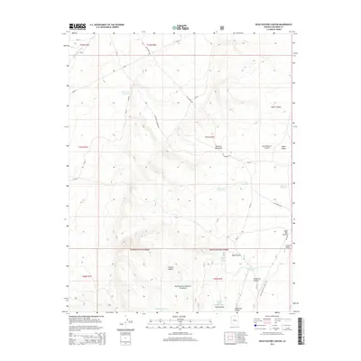
2014 Map of Buck Pasture Canyon
USGS Topo · Published 2014About this map
The Arizona National Scenic Trail winds through this high-altitude landscape, crossing the southern portion of the sheet near Orderville Canyon. This section of the Kaibab National Forest is defined by a series of land management and water collection points necessary for survival in the arid Arizona interior. The historical Old Arizona Rd serves as the primary artery through the terrain, connecting various catchments and reservoirs.
Find a feature on this map
38 named features on this map. Tap any name to fly to it.
Don’t see what you’re looking for? This feature index may not catch every label — zoom into the map to look around manually.
Map Details
Editions of this 2014 Buck Pasture Canyon Map
This is the sole edition of this map. No revisions or reprints were ever made.
Other maps of this area

1886 · Kanab
USGS Topo · 1:250,000

1886 · Kaibab
USGS Topo · 1:250,000

1953 · Cedar City
USGS Topo · 1:250,000

1953 · Grand Canyon
USGS Topo · 1:250,000

1954 · Buckskin Gulch SE
USGS Topo · 1:24,000

1954 · Buckskin Gulch SW
USGS Topo · 1:24,000

1954 · Johnson SE
USGS Topo · 1:24,000
1954 · House Rock Spring NE
USGS Topo · 1:24,000
1954 · House Rock Spring SE
USGS Topo · 1:24,000

1954 · Buckskin Gulch
USGS Topo · 1:62,500