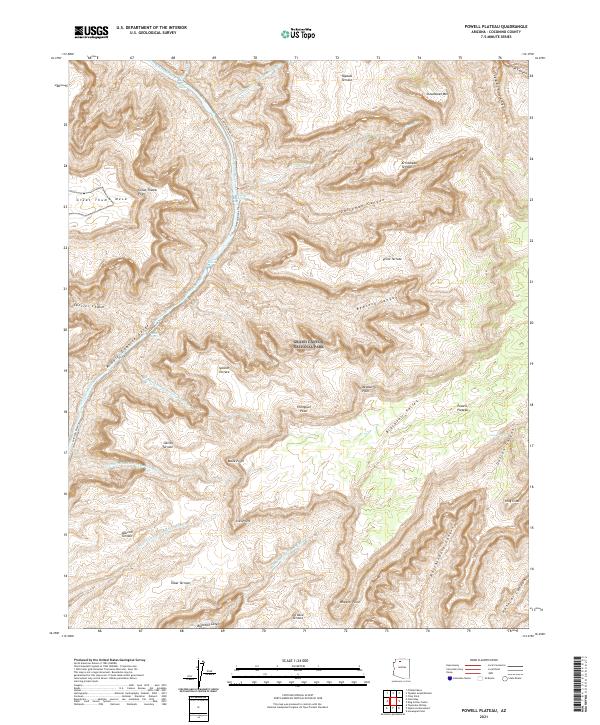
2021 Map of Powell Plateau
USGS Topo · Published 2021About this map
Grand Canyon National Park encompasses this entire landscape, defined by the winding course of the Colorado River and its dramatic vertical transitions. The northern reaches are dominated by Great Thumb Mesa and Great Thumb Point, leading toward the expansive Powell Plateau. Along the river’s path, the Middle Granite Gorge cuts deep through the canyon floor, marked by hazardous points such as Tapeats Rapids, Bedrock Rapids, and Deubendorff Rapids. High above the water, numerous terraces like Feroz Terrace, Specter Terrace, and Alarcon Terrace provide distinct geological steps. The map also traces the Colorado River Trl as it follows the river's edge through Specter Chasm, while named drainages like Hakatai Canyon and Blacktail Canyon reveal the intricate erosion patterns of this desert terrain.
Find a feature on this map
47 named features on this map. Tap any name to fly to it.
Don’t see what you’re looking for? This feature index may not catch every label — zoom into the map to look around manually.
Map Details
Editions of this 2021 Powell Plateau Map
This is the sole edition of this map. No revisions or reprints were ever made.
Other maps of this area

1886 · Kaibab
USGS Topo · 1:250,000

1953 · Grand Canyon
USGS Topo · 1:250,000

1957 · Grand Canyon
USGS Topo · 1:250,000

1958 · Grand Canyon
USGS Topo · 1:250,000

1960 · Grand Canyon
USGS Topo · 1:250,000

1962 · Kanab Point
USGS Topo · 1:62,500

1962 · Havasupai Point
USGS Topo · 1:62,500
1962 · Powell Plateau
USGS Topo · 1:62,500

1962 · Supai
USGS Topo · 1:62,500

1984 · Grand Canyon
USGS Topo · 1:100,000