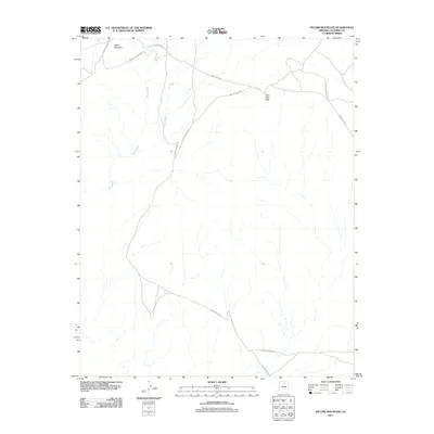
2011 Map of Pillow Mountain
USGS Topo · Published 2011About this map
Pillow Mountain and the Red Point Hills define this high-desert landscape within the Navajo Nation. This 2011 survey documents a network of critical arterial roads, including Navajo Reservation Rd and several numbered routes such as Indian Rte-6132 and Indian Rte-6130. These corridors trace the natural drainage patterns of the region, specifically following the paths carved by Sheep Wash and Dry Wash. The presence of a Forest Service Rd in the southeastern quadrant suggests the transition toward managed federal lands. This map is essential for understanding the modern infrastructure and geographic layout of this specific corner of Coconino County, providing a clear view of how transportation routes navigate the arid terrain and local summits.
Find a feature on this map
10 named features on this map. Tap any name to fly to it.
Don’t see what you’re looking for? This feature index may not catch every label — zoom into the map to look around manually.
Map Details
Editions of this 2011 Pillow Mountain Map
This is the sole edition of this map. No revisions or reprints were ever made.
Other maps of this area

1886 · Echo Cliffs
USGS Topo · 1:250,000

1891 · Echo Cliffs
USGS Topo · 1:250,000

1954 · Shinumo Altar SE
USGS Topo · 1:24,000

1954 · Shinumo Altar
USGS Topo · 1:62,500

1955 · Blue Spring NE
USGS Topo · 1:24,000
1955 · Blue Spring SE
USGS Topo · 1:24,000

1955 · Moa Ave NW
USGS Topo · 1:24,000
1955 · Moa Ave SW
USGS Topo · 1:24,000

1955 · Blue Spring
USGS Topo · 1:62,500

1956 · Marble Canyon
USGS Topo · 1:250,000