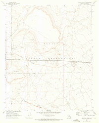
1969 Map of Grand Falls SW
USGS Topo · Published 1972About this map
The Navajo Indian Reservation landscape is defined by the ephemeral path of the San Francisco Wash and the straight-line utility of mid-century infrastructure. Documented through 1968 aerial photography and 1969 field checks, the area shows a distinct pattern of arid-land management, featuring several Pipelines and specialized water structures like a Water Tank and Catchment Basin. Transport across this Coconino County terrain is anchored by Leupp Road, which cuts east-to-west through a landscape marked by scattered archaeological Ruins and industrial Gravel Pits. The interplay of these ancient and modern features provides a clear look at how the high desert was navigated and utilized before the expansion of more modern developments.
Find a feature on this map
9 named features on this map. Tap any name to fly to it.
Don’t see what you’re looking for? This feature index may not catch every label — zoom into the map to look around manually.
Map Details
Editions of this 1969 Grand Falls SW Map
This is the sole edition of this map. No revisions or reprints were ever made.
Other maps of this area

1886 · San Francisco Mtns
USGS Topo · 1:250,000

1891 · San Francisco Mtns
USGS Topo · 1:250,000

1894 · San Francisco Mtns
USGS Topo · 1:250,000

1899 · San Francisco Mtns
USGS Topo · 1:250,000

1947 · Flagstaff
USGS Topo · 1:250,000

1954 · Flagstaff
USGS Topo · 1:250,000

1955 · Grand Falls NE
USGS Topo · 1:24,000

1958 · Flagstaff
USGS Topo · 1:250,000

1960 · Flagstaff
USGS Topo · 1:250,000

1962 · Flagstaff
USGS Topo · 1:250,000