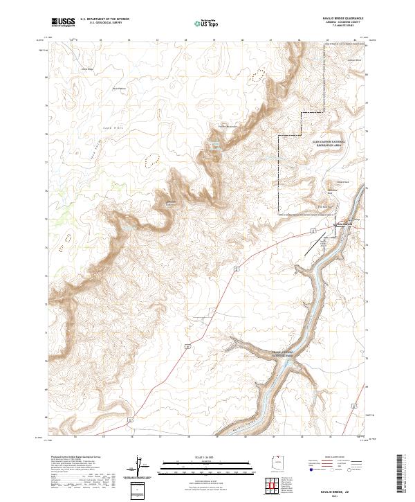
2021 Map of Navajo Bridge
USGS Topo · Published 2021About this map
Colorado River navigation and the geography of the northern Arizona borderlands define this area where the Glen Canyon National Recreation Area meets Grand Canyon National Park. The landscape is dominated by the dramatic elevation changes of the Vermilion Cliffs and the Paria Plateau, with the Navajo Bridge serving as a critical crossing point over the river gorge. The settlement of Marble Canyon sits at the base of these cliffs, supported by the Marble Canyon Airport and access via Lees Ferry Road. Interpretive details show the hydraulic character of the canyon, from the Badger Creek Rapids to the Cathedral Wash. Local landmarks like Powells Monument and Cathedral Rock offer precise points of reference for those tracing the history of river expeditions or land surveys in this section of Coconino County.
Find a feature on this map
30 named features on this map. Tap any name to fly to it.
Don’t see what you’re looking for? This feature index may not catch every label — zoom into the map to look around manually.
Map Details
Editions of this 2021 Navajo Bridge Map
This is the sole edition of this map. No revisions or reprints were ever made.
Other maps of this area

1886 · Echo Cliffs
USGS Topo · 1:250,000

1891 · Echo Cliffs
USGS Topo · 1:250,000

1951 · Lees Ferry NE
USGS Topo · 1:24,000

1954 · Lees Ferry NW
USGS Topo · 1:24,000

1954 · Emmett Wash NE
USGS Topo · 1:24,000

1954 · Paria Plateau SE
USGS Topo · 1:24,000

1954 · Lees Ferry SE
USGS Topo · 1:24,000

1954 · Lees Ferry SW
USGS Topo · 1:24,000

1954 · Tanner Wash
USGS Topo · 1:62,500

1954 · Emmett Wash
USGS Topo · 1:62,500