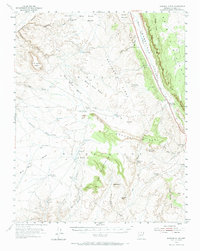
1954 Map of Shinumo Altar
USGS Topo · Published 1967About this map
Navajo Indian Reservation lands dominate this mid-century survey of the Arizona high desert, centered on the striking geological formation of Shinumo Altar. The landscape is defined by the massive Echo Cliffs and the rising Kaibito Plateau to the east, which frame the long corridor of Cedar Ridge Valley. Human presence is sparse but centered on the Cedar Ridge Trading Post, a vital outpost for commerce and communication in this arid region during the early 1950s.
Find a feature on this map
48 named features on this map. Tap any name to fly to it.
Don’t see what you’re looking for? This feature index may not catch every label — zoom into the map to look around manually.
Map Details
Editions of this 1954 Shinumo Altar Map
2 editions found
Other maps of this area

1886 · Echo Cliffs
USGS Topo · 1:250,000

1891 · Echo Cliffs
USGS Topo · 1:250,000

1907 · Vishnu
USGS Topo · 1:48,000

1954 · Shinumo Altar NE
USGS Topo · 1:24,000

1954 · Shinumo Altar SE
USGS Topo · 1:24,000

1954 · Nankoweap
USGS Topo · 1:62,500

1954 · Tanner Wash
USGS Topo · 1:62,500

1954 · Emmett Wash
USGS Topo · 1:62,500

1954 · Shinumo Altar
USGS Topo · 1:62,500

1955 · Blue Spring NE
USGS Topo · 1:24,000