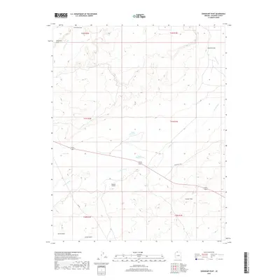
2018 Map of Shinarump Point
USGS Topo · Published 2018About this map
Shinarump Point anchors the high ground in this arid Coconino County landscape, where water management is central to the human footprint. Significant ranching and land-use markers like Hatch Brothers Tank and Pratt Reservoir demonstrate the vital infrastructure required for life in the high desert. The terrain is deeply incised by drainage systems such as Johnson Wash and Lost Spring Wash, which cut through the complex topography of the Arizona Strip. Movement through the area is dictated by natural breaks in the cliffs, most notably at Lost Spring Gap and Eightmile Gap. High-clearance routes like Ryan Rd and Winter Rd connect these remote points, while the path of Alt 89 provides the primary corridor through the southern reaches near Wildcat Canyon and Crowbar Point.
Find a feature on this map
20 named features on this map. Tap any name to fly to it.
Don’t see what you’re looking for? This feature index may not catch every label — zoom into the map to look around manually.
Map Details
Editions of this 2018 Shinarump Point Map
This is the sole edition of this map. No revisions or reprints were ever made.
Other maps of this area

1886 · Kanab
USGS Topo · 1:250,000

1886 · Kaibab
USGS Topo · 1:250,000

1953 · Cedar City
USGS Topo · 1:250,000

1953 · Grand Canyon
USGS Topo · 1:250,000

1954 · Johnson SE
USGS Topo · 1:24,000

1954 · Kanab SE
USGS Topo · 1:24,000

1954 · Shinarump NW
USGS Topo · 1:24,000

1954 · Johnson SW
USGS Topo · 1:24,000

1954 · Fredonia NE
USGS Topo · 1:24,000

1954 · Fredonia
USGS Topo · 1:62,500