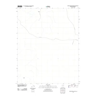
2011 Map of Preston Mesa South
USGS Topo · Published 2011About this map
Preston Mesa dominates the northern landscape of this Coconino County terrain, characterized by a network of drainage patterns and high-desert topography. This modern era study reflects the enduring road network of the region, specifically documenting the routes that navigate this part of Arizona. The primary transportation artery, Indian Rte-6231, traverses the central portion of the map, while Ind Route 6231 Loop and Indian Rte-6230 serve the eastern edge. In the southwest, the overlook at White Point provides a significant landmark within the otherwise sparse and open landscape. These routes, including Indian Rte-215 near the mesa, illustrate the essential connectivity required in this vast desert environment, mapping out the precise paths used to cross the plateau.
Find a feature on this map
6 named features on this map. Tap any name to fly to it.
Don’t see what you’re looking for? This feature index may not catch every label — zoom into the map to look around manually.
Map Details
Editions of this 2011 Preston Mesa South Map
This is the sole edition of this map. No revisions or reprints were ever made.
Other maps of this area

1886 · Echo Cliffs
USGS Topo · 1:250,000

1891 · Echo Cliffs
USGS Topo · 1:250,000

1956 · Marble Canyon
USGS Topo · 1:250,000

1959 · Marble Canyon
USGS Topo · 1:250,000

1961 · Marble Canyon
USGS Topo · 1:250,000
1969 · Tuba City NE
USGS Topo · 1:24,000
1969 · Tuba City
USGS Topo · 1:24,000
1969 · Moenave
USGS Topo · 1:24,000
1981 · Big Whisker Well
USGS Topo · 1:24,000
1982 · Gopher Spring
USGS Topo · 1:24,000