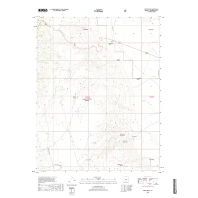
2018 Map of House Rock
USGS Topo · Published 2018About this map
The Kaibab National Forest dominates this high-elevation landscape in Coconino County, where the eastern edge of the Kaibab Plateau descends into dramatic canyon systems. This 2018 survey documents a region defined by steep topographical shifts, from the heights of Big Ridge and Little Mtn to the depths of House Rock Canyon and Rock Canyon. The geography here is marked by its arid nature, where vital water sources are restricted to named catchments like Murray Tank, Findley Tank, and the ephemeral Rock Spring.
Find a feature on this map
23 named features on this map. Tap any name to fly to it.
Don’t see what you’re looking for? This feature index may not catch every label — zoom into the map to look around manually.
Map Details
Editions of this 2018 House Rock Map
This is the sole edition of this map. No revisions or reprints were ever made.
Other maps of this area

1886 · Echo Cliffs
USGS Topo · 1:250,000

1886 · Kaibab
USGS Topo · 1:250,000

1891 · Echo Cliffs
USGS Topo · 1:250,000

1936 · Jacobs Lake
USGS Topo · 1:48,000

1940 · Jacob Lake
USGS Topo · 1:62,500

1953 · Jacobs Lake
USGS Topo · 1:62,500

1953 · Grand Canyon
USGS Topo · 1:250,000

1954 · Emmett Wash NW
USGS Topo · 1:24,000

1954 · Paria Plateau SW
USGS Topo · 1:24,000

1954 · Emmett Wash
USGS Topo · 1:62,500