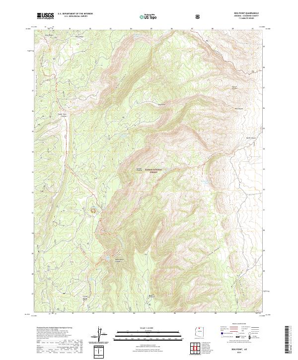
2021 Map of Dog Point
USGS Topo · Published 2021About this map
The Kaibab National Forest dominates this section of the high North Rim country, where complex drainages like Tater Canyon and Dog Canyon carve through the Kaibab Plateau. This 2021 survey shows a landscape defined by its vital water sources, from man-made improvements like Mackelprang Tank and Dog Canyon Tank to natural seeps such as Crystal Spring and North Canyon Spring. A network of long-distance routes, including the Arizona National Scenic Trl and the Great Western Trl, traverses the terrain, connecting high points like Dog Point and Tater Ridge. Geologic features are prominent throughout, notably the Marble Sinkhole and the distinctive ridgelines of the Cocks Combs. The mapping reflects a region managed for conservation and recreation, where the names often echo the ranching and pioneer history of the Arizona Strip.
Find a feature on this map
34 named features on this map. Tap any name to fly to it.
Don’t see what you’re looking for? This feature index may not catch every label — zoom into the map to look around manually.
Map Details
Editions of this 2021 Dog Point Map
This is the sole edition of this map. No revisions or reprints were ever made.
Other maps of this area

1886 · Echo Cliffs
USGS Topo · 1:250,000

1886 · Kaibab
USGS Topo · 1:250,000

1891 · Echo Cliffs
USGS Topo · 1:250,000

1936 · Jacobs Lake
USGS Topo · 1:48,000

1940 · Jacob Lake
USGS Topo · 1:62,500

1953 · Jacobs Lake
USGS Topo · 1:62,500

1953 · Grand Canyon
USGS Topo · 1:250,000

1954 · Nankoweap
USGS Topo · 1:62,500

1954 · Emmett Wash
USGS Topo · 1:62,500

1956 · Marble Canyon
USGS Topo · 1:250,000