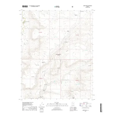
2018 Map of Jumpup Point
USGS Topo · Published 2018About this map
Kaibab National Forest dominates this high-elevation landscape on the border of Mohave and Coconino counties. The map centers on the dramatic relief of Jumpup Point and Sowats Point, where the terrain drops sharply into a complex system of drainages including Jumpup Canyon and Sowats Canyon. This 2018 survey reveals a territory defined by its water sources, with numerous named springs such as Bitter Spring, White Spring, and Mountain Sheep Spring providing critical points of interest across the arid plateaus.
Find a feature on this map
36 named features on this map. Tap any name to fly to it.
Don’t see what you’re looking for? This feature index may not catch every label — zoom into the map to look around manually.
Map Details
Editions of this 2018 Jumpup Point Map
This is the sole edition of this map. No revisions or reprints were ever made.
Other maps of this area

1886 · Kaibab
USGS Topo · 1:250,000

1953 · Grand Canyon
USGS Topo · 1:250,000

1957 · Grand Canyon
USGS Topo · 1:250,000

1957 · Jumpup Canyon
USGS Topo · 1:62,500

1958 · Grand Canyon
USGS Topo · 1:250,000

1958 · Big Springs
USGS Topo · 1:62,500

1960 · Grand Canyon
USGS Topo · 1:250,000

1962 · Kanab Point
USGS Topo · 1:62,500
1962 · Powell Plateau
USGS Topo · 1:62,500

1984 · Grand Canyon
USGS Topo · 1:100,000