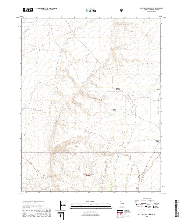
2021 Map of Buck Pasture Canyon
USGS Topo · Published 2021About this map
Kaibab National Forest dominates the southern reaches of this high-altitude landscape, where the Buckskin Mountains meet the northern edge of the Kaibab Plateau. The map documents a rugged network of seasonal water management and historic travel routes, featuring the Old Arizona Catchment and Winter Road Catchment, which highlight the critical role of water storage in this arid environment. Significant north-south corridors like Old Arizona Rd and Winter Rd intersect the terrain, providing access to remote landmarks such as Buck Pasture Canyon and Dead-Man Pockets. For hikers and history buffs, the inclusion of the Arizona National Scenic Trl and the Great Western Trl as they pass through Summit Valley provides a contemporary record of long-distance trail infrastructure in the American Southwest.
Find a feature on this map
28 named features on this map. Tap any name to fly to it.
Don’t see what you’re looking for? This feature index may not catch every label — zoom into the map to look around manually.
Map Details
Editions of this 2021 Buck Pasture Canyon Map
This is the sole edition of this map. No revisions or reprints were ever made.
Other maps of this area

1886 · Kanab
USGS Topo · 1:250,000

1886 · Kaibab
USGS Topo · 1:250,000

1953 · Cedar City
USGS Topo · 1:250,000

1953 · Grand Canyon
USGS Topo · 1:250,000

1954 · Buckskin Gulch SE
USGS Topo · 1:24,000

1954 · Buckskin Gulch SW
USGS Topo · 1:24,000

1954 · Johnson SE
USGS Topo · 1:24,000
1954 · House Rock Spring NE
USGS Topo · 1:24,000
1954 · House Rock Spring SE
USGS Topo · 1:24,000

1954 · Buckskin Gulch
USGS Topo · 1:62,500