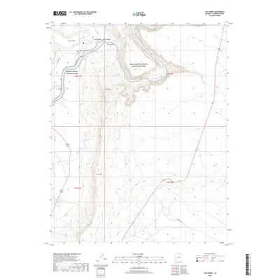
2018 Map of Lees Ferry
USGS Topo · Published 2018About this map
Marble Canyon and Glen Canyon meet at the confluence of the Colorado River and the Paria River, marking a critical transition point in the northern Arizona landscape. The presence of Lees Ferry Rd and access points like Secret Beach and the Paria Riffle indicate the area's historical and modern significance as a rare river crossing. To the south, the dramatic rising of the Echo Cliffs and Echo Peak dominate the skyline above the desert floor, where water sources like Navajo Springs and Navajo Spring provided essential stopovers for travelers. This topography illustrates the intersection of major federal lands, where Grand Canyon National Park and the Glen Canyon National Recreation Area converge along the river corridor.
Find a feature on this map
23 named features on this map. Tap any name to fly to it.
Don’t see what you’re looking for? This feature index may not catch every label — zoom into the map to look around manually.
Map Details
Editions of this 2018 Lees Ferry Map
This is the sole edition of this map. No revisions or reprints were ever made.
Other maps of this area

1886 · Echo Cliffs
USGS Topo · 1:250,000

1891 · Echo Cliffs
USGS Topo · 1:250,000

1951 · Lees Ferry NE
USGS Topo · 1:24,000

1954 · Lees Ferry NW
USGS Topo · 1:24,000

1954 · Lees Ferry SE
USGS Topo · 1:24,000

1954 · Lees Ferry SW
USGS Topo · 1:24,000

1954 · Tanner Wash
USGS Topo · 1:62,500

1954 · Leche-E Rock
USGS Topo · 1:62,500

1954 · Lees Ferry
USGS Topo · 1:62,500

1955 · Tanner Wash NE
USGS Topo · 1:24,000