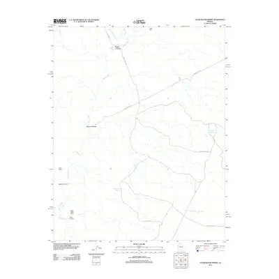
2011 Map of Clear Water Spring
USGS Topo · Published 2011About this map
Kanab Creek and its network of ephemeral washes define this stretch of the Arizona strip, where vital water sources were carefully managed at the start of the 21st century. The map highlights the sparse infrastructure of the region, anchored by historic route markers such as Nagles Crossing and Booze Crossing. These sites, along with Nagles Rd and various forest service routes, indicate the long-standing importance of reliable passage through the canyon country.
Find a feature on this map
17 named features on this map. Tap any name to fly to it.
Don’t see what you’re looking for? This feature index may not catch every label — zoom into the map to look around manually.
Map Details
Editions of this 2011 Clear Water Spring Map
This is the sole edition of this map. No revisions or reprints were ever made.
Other maps of this area

1886 · Kaibab
USGS Topo · 1:250,000

1953 · Grand Canyon
USGS Topo · 1:250,000

1954 · Fredonia NW
USGS Topo · 1:24,000

1954 · Shinarump NW
USGS Topo · 1:24,000

1954 · Fredonia SW
USGS Topo · 1:24,000

1954 · Fredonia NE
USGS Topo · 1:24,000

1954 · Fredonia
USGS Topo · 1:62,500

1957 · Grand Canyon
USGS Topo · 1:250,000

1957 · Shinarump SW
USGS Topo · 1:24,000
1957 · Shinarump
USGS Topo · 1:62,500