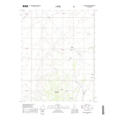
2018 Map of Buck Pasture Canyon
USGS Topo · Published 2018About this map
Kaibab National Forest dominates this high-altitude landscape in Coconino County, where the terrain transitions across the Kaibab Plateau and the Buckskin Mountains. The map reveals a sophisticated system of water management in an arid environment, including the Old Arizona Catchment, Winter Road Catchment, and Rock Canyon Reservoir. These features, along with names like Dead-Man Pockets and Wagon Hollow, reflect the area's history of cattle ranching and early overland travel. Long-distance movement is highlighted by the intersection of the Arizona National Scenic Trail and the Great Western Trail as they pass near Cooper Ridge and Round Valley. This document provides an essential record of the forest service infrastructure and topographic character of the northern Arizona strip just before the end of the second decade of the 21st century.
Find a feature on this map
29 named features on this map. Tap any name to fly to it.
Don’t see what you’re looking for? This feature index may not catch every label — zoom into the map to look around manually.
Map Details
Editions of this 2018 Buck Pasture Canyon Map
This is the sole edition of this map. No revisions or reprints were ever made.
Other maps of this area

1886 · Kanab
USGS Topo · 1:250,000

1886 · Kaibab
USGS Topo · 1:250,000

1953 · Cedar City
USGS Topo · 1:250,000

1953 · Grand Canyon
USGS Topo · 1:250,000

1954 · Buckskin Gulch SE
USGS Topo · 1:24,000

1954 · Buckskin Gulch SW
USGS Topo · 1:24,000

1954 · Johnson SE
USGS Topo · 1:24,000
1954 · House Rock Spring NE
USGS Topo · 1:24,000
1954 · House Rock Spring SE
USGS Topo · 1:24,000

1954 · Buckskin Gulch
USGS Topo · 1:62,500