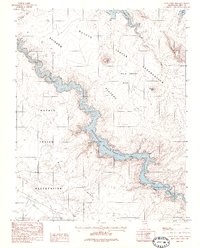
1985 Map of Wild Horse Mesa
USGS Topo · Published 1985About this map
Navajo Indian Reservation lands dominate this high-desert landscape, where the rising waters of Lake Powell wind through deep sandstone corridors. Mapped during the mid-1980s, the terrain shows the complex relationship between the newly established Glen Canyon National Recreation Area and ancestral tribal territories. The intricate shoreline of the reservoir reaches into Labyrinth Bay and snakes through the Canyon, contrasting with the massive, flat-topped silhouettes of Wild Horse Mesa and Rainbow Plateau.
Find a feature on this map
14 named features on this map. Tap any name to fly to it.
Don’t see what you’re looking for? This feature index may not catch every label — zoom into the map to look around manually.
Map Details
Editions of this 1985 Wild Horse Mesa Map
This is the sole edition of this map. No revisions or reprints were ever made.
Other maps of this area

1886 · Escalante
USGS Topo · 1:250,000

1886 · Echo Cliffs
USGS Topo · 1:250,000

1891 · Echo Cliffs
USGS Topo · 1:250,000

1922 · Warm Creek
USGS Topo · 1:63,360

1953 · Cummings Mesa
USGS Topo · 1:62,500

1953 · Gunsight Butte
USGS Topo · 1:62,500

1954 · Leche-E Rock
USGS Topo · 1:62,500

1954 · Navajo Creek
USGS Topo · 1:62,500

1956 · Escalante
USGS Topo · 1:250,000

1956 · Marble Canyon
USGS Topo · 1:250,000