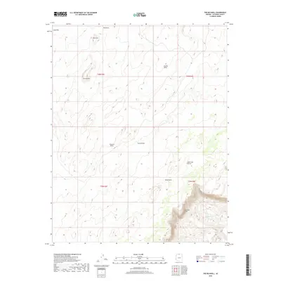
2018 Map of The Big Knoll
USGS Topo · Published 2018About this map
The Vermilion Cliffs dominate the southeastern portion of this landscape, rising sharply from the surrounding terrain to define the edge of the high desert. This 2018 survey reveals a topography characterized by isolated peaks and valleys, such as The Big Knoll and Pinnacle Valley, which indicate a complex geomorphology of eroded sandstone and high-altitude plateaus. The presence of Cottonwood Spring suggests a critical water source in an otherwise arid environment, potentially serving as a focal point for livestock and wildlife within the Soap Creek Pasture.
Find a feature on this map
15 named features on this map. Tap any name to fly to it.
Don’t see what you’re looking for? This feature index may not catch every label — zoom into the map to look around manually.
Map Details
Editions of this 2018 The Big Knoll Map
This is the sole edition of this map. No revisions or reprints were ever made.
Other maps of this area

1886 · Echo Cliffs
USGS Topo · 1:250,000

1891 · Echo Cliffs
USGS Topo · 1:250,000

1954 · Lees Ferry NW
USGS Topo · 1:24,000

1954 · Emmett Wash NE
USGS Topo · 1:24,000

1954 · Emmett Wash NW
USGS Topo · 1:24,000

1954 · Paria Plateau SE
USGS Topo · 1:24,000

1954 · Paria Plateau NW
USGS Topo · 1:24,000

1954 · Paria Plateau SW
USGS Topo · 1:24,000

1954 · Lees Ferry SW
USGS Topo · 1:24,000

1954 · Tanner Wash
USGS Topo · 1:62,500