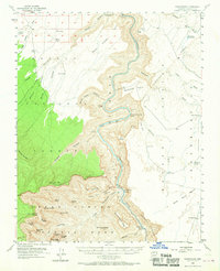
1954 Map of Nankoweap
USGS Topo · Published 1970About this map
Colorado River whitewater and sheer canyon walls dominate this mid-century survey, which reveals the complex vertical geography where the Kaibab National Forest meets the Grand Canyon National Park. The landscape is a corridor of dramatic drops, punctuated by President Harding Rapids and Nankoweap Rapids. Along the riverbanks, evidence of ancient and modern land use appears in the form of Cliff Dwellings near Nankoweap Canyon and a Tramway Tower on the eastern bank.
Find a feature on this map
61 named features on this map. Tap any name to fly to it.
Don’t see what you’re looking for? This feature index may not catch every label — zoom into the map to look around manually.
Map Details
Editions of this 1954 Nankoweap Map
4 editions found

Other maps of this area

1886 · Echo Cliffs
USGS Topo · 1:250,000

1886 · Kaibab
USGS Topo · 1:250,000

1891 · Echo Cliffs
USGS Topo · 1:250,000

1903 · Bright Angel
USGS Topo · 1:48,000

1906 · Bright Angel
USGS Topo · 1:48,000

1907 · Vishnu
USGS Topo · 1:48,000

1936 · Jacobs Lake
USGS Topo · 1:48,000

1940 · Jacob Lake
USGS Topo · 1:62,500

1953 · Jacobs Lake
USGS Topo · 1:62,500

1953 · Grand Canyon
USGS Topo · 1:250,000