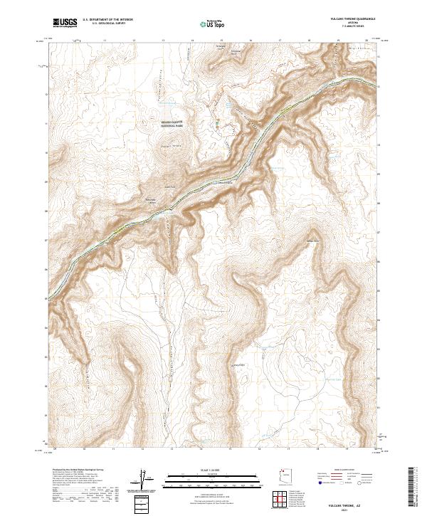
2021 Map of Vulcans Throne
USGS Topo · Published 2021About this map
Vulcans Throne stands as a prominent landmark overlooking the Colorado River within Grand Canyon National Park. This portion of the North Rim captures a complex landscape of vertical relief, where the Toroweap Cliffs and Aubrey Cliffs define the eastern and western horizons. The map documents the intricate river corridor, featuring the renowned Lava Falls and Lava Falls Rapids, alongside distinctive geological formations like the Lava Pinnacle and the expansive Esplanade Bench. The intersection of Mohave and Coconino counties runs directly through the river channel, illustrating how natural features historically dictated administrative boundaries. Evidence of the area's hydrology and transit is found in the various livestock tanks such as Mustang Tank and Cougar Tank, and primitive routes like the Colorado River Trl and Tuckup Trl that navigate the steep descents of Prospect Canyon.
Find a feature on this map
40 named features on this map. Tap any name to fly to it.
Don’t see what you’re looking for? This feature index may not catch every label — zoom into the map to look around manually.
Map Details
Editions of this 2021 Vulcans Throne Map
This is the sole edition of this map. No revisions or reprints were ever made.
Other maps of this area

1886 · Mt. Trumbull
USGS Topo · 1:250,000

1886 · Kaibab
USGS Topo · 1:250,000

1892 · Mt. Trumbull
USGS Topo · 1:250,000

1953 · Grand Canyon
USGS Topo · 1:250,000

1957 · Grand Canyon
USGS Topo · 1:250,000

1958 · Grand Canyon
USGS Topo · 1:250,000

1960 · Grand Canyon
USGS Topo · 1:250,000

1962 · Tuckup Canyon
USGS Topo · 1:62,500

1962 · National Canyon
USGS Topo · 1:62,500
1967 · Vulcans Throne
USGS Topo · 1:24,000