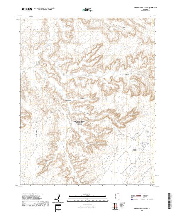
2021 Map of Toenleshushe Canyon
USGS Topo · Published 2021About this map
Navajo National Monument and the surrounding high desert topography dominate this portion of Coconino County, characterized by a complex network of deep drainages. The landscape is defined by massive sandstone features, including the Natural Arch and Eggshell Arch, which stand near the winding course of Toenleshushe Canyon. This area is a significant archaeological and geological study site, notably containing the Inscription House Ruin Spring, a name that points to the ancestral Puebloan cliff dwellings protected within the monument's boundaries.
Find a feature on this map
22 named features on this map. Tap any name to fly to it.
Don’t see what you’re looking for? This feature index may not catch every label — zoom into the map to look around manually.
Map Details
Editions of this 2021 Toenleshushe Canyon Map
This is the sole edition of this map. No revisions or reprints were ever made.
Other maps of this area

1883 · Marsh Pass
USGS Topo · 1:250,000

1892 · Marsh Pass
USGS Topo · 1:250,000

1956 · Marble Canyon
USGS Topo · 1:250,000

1959 · Marble Canyon
USGS Topo · 1:250,000

1961 · Marble Canyon
USGS Topo · 1:250,000

1970 · Square Butte
USGS Topo · 1:24,000

1970 · Whirlwind Rock
USGS Topo · 1:24,000
1970 · Chaiyahi Rim SW
USGS Topo · 1:24,000
1970 · Two Red Mesas
USGS Topo · 1:24,000
1970 · Shonto
USGS Topo · 1:24,000