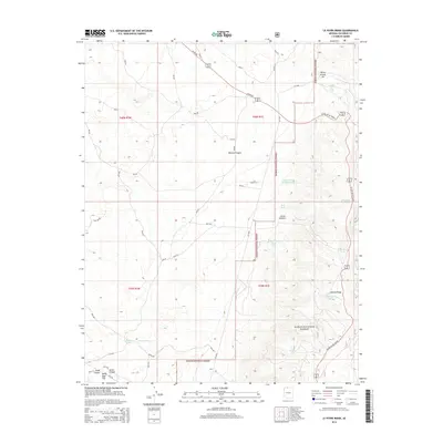
2014 Map of Le Fevre Ridge
USGS Topo · Published 2014About this map
Kaibab National Forest dominates this northern Arizona landscape, where the high plateau is marked by a sophisticated network of water management features essential for ranching and wildlife. The map reveals a high concentration of livestock and wildlife watering infrastructure, including Judd Tank, Henrie Tank, and the specialized Cutler Pockets Trick Tank. These artificial catchments are scattered across land characterized by significant terrain shifts, from the depths of Wildcat Canyon to the prominent Lefevre Ridge. Industrial activity is represented by the Wittis Gravel Pit in the northeast, while the transit corridor of US Hwy 89 Alt Scenic provides the primary artery through the forest. This 2014 survey documents a rugged environment where natural features like White Sage Flat and Hidden Lake intersect with modern forest management and resource extraction.
Find a feature on this map
25 named features on this map. Tap any name to fly to it.
Don’t see what you’re looking for? This feature index may not catch every label — zoom into the map to look around manually.
Map Details
Editions of this 2014 Le Fevre Ridge Map
This is the sole edition of this map. No revisions or reprints were ever made.
Other maps of this area

1886 · Kaibab
USGS Topo · 1:250,000

1936 · Jacobs Lake
USGS Topo · 1:48,000

1940 · Jacob Lake
USGS Topo · 1:62,500

1953 · Jacobs Lake
USGS Topo · 1:62,500

1953 · Grand Canyon
USGS Topo · 1:250,000

1954 · Shinarump NW
USGS Topo · 1:24,000

1957 · Grand Canyon
USGS Topo · 1:250,000
1957 · Shinarump NE
USGS Topo · 1:24,000
1957 · House Rock Spring NW
USGS Topo · 1:24,000

1957 · Shinarump SE
USGS Topo · 1:24,000