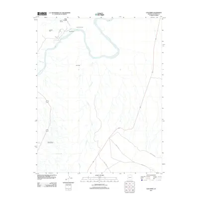
2011 Map of Lees Ferry
USGS Topo · Published 2011About this map
Lees Ferry (historical) marks a critical point of confluence where the Paria River meets the Colorado River at the head of the Grand Canyon. This 2011 survey documents the geography of this northern Arizona corridor, capturing the transition from Glen Canyon to the marble-walled canyon systems downstream. The landscape is defined by its water sources, including the isolated Navajo Springs and Navajo Spring to the southwest, which stand in contrast to the deep drainage of Fall Creek. Transportation routes such as Lees Ferry Rd and Indian Rte-9211 navigate the high desert floor, providing access to landmarks like the Navajo Springs Maintenance Yard and the rugged overlooks at Johnson Point and Echo Peak. The presence of Paria Riffle and Chair Crossing underscores the historical importance of this reach for river navigation and early canyon access.
Find a feature on this map
17 named features on this map. Tap any name to fly to it.
Don’t see what you’re looking for? This feature index may not catch every label — zoom into the map to look around manually.
Map Details
Editions of this 2011 Lees Ferry Map
This is the sole edition of this map. No revisions or reprints were ever made.
Other maps of this area

1886 · Echo Cliffs
USGS Topo · 1:250,000

1891 · Echo Cliffs
USGS Topo · 1:250,000

1951 · Lees Ferry NE
USGS Topo · 1:24,000

1954 · Lees Ferry NW
USGS Topo · 1:24,000

1954 · Lees Ferry SE
USGS Topo · 1:24,000

1954 · Lees Ferry SW
USGS Topo · 1:24,000

1954 · Tanner Wash
USGS Topo · 1:62,500

1954 · Leche-E Rock
USGS Topo · 1:62,500

1954 · Lees Ferry
USGS Topo · 1:62,500

1955 · Tanner Wash NE
USGS Topo · 1:24,000