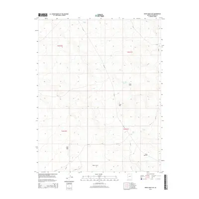
2014 Map of White Sage Flat
USGS Topo · Published 2014About this map
White Sage Flat dominates the southeastern quadrant of this Coconino County terrain, illustrating the high-altitude arid landscape of Northern Arizona. The network of drainage and water management is highly evident through numerous namesake features like Whiting Tank, Hatch Tank, and Jensen Tank, which are vital for supporting life and land use in this open country. The presence of Ryan Rd cutting through the center of the sheet provides a primary axis for travel through the varying elevations of Jacob Canyon and past the distinctive Cedar Knoll. This 2014 representation of the area, including the public land identifiers such as BLM-166 and BLM-164, reflects the ongoing management of the region by the Bureau of Land Management, maintaining the character of the Arizona strip.
Find a feature on this map
20 named features on this map. Tap any name to fly to it.
Don’t see what you’re looking for? This feature index may not catch every label — zoom into the map to look around manually.
Map Details
Editions of this 2014 White Sage Flat Map
This is the sole edition of this map. No revisions or reprints were ever made.
Other maps of this area

1886 · Kaibab
USGS Topo · 1:250,000

1953 · Grand Canyon
USGS Topo · 1:250,000

1954 · Shinarump NW
USGS Topo · 1:24,000

1954 · Fredonia NE
USGS Topo · 1:24,000

1954 · Fredonia
USGS Topo · 1:62,500

1957 · Grand Canyon
USGS Topo · 1:250,000
1957 · Shinarump NE
USGS Topo · 1:24,000

1957 · Shinarump SE
USGS Topo · 1:24,000

1957 · Shinarump SW
USGS Topo · 1:24,000
1957 · Shinarump
USGS Topo · 1:62,500