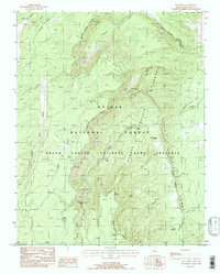
1988 Map of Dog Point
USGS Topo · Published 1988About this map
Cane Ridge and the deep incisions of Tater Canyon dominate this high-elevation landscape within the Kaibab National Forest. Recorded in the late 1980s, the map illustrates a region managed for conservation and wildlife, specifically as part of the Grand Canyon National Game Preserve. Water is the defining resource here, evidenced by numerous tanks and springs like Tater Canyon Springs, Dog Lake, and Kanabownits Spring, which support the seasonal movement of life through this plateau country.
Find a feature on this map
27 named features on this map. Tap any name to fly to it.
Don’t see what you’re looking for? This feature index may not catch every label — zoom into the map to look around manually.
Map Details
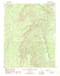
Editions of this 1988 Dog Point Map
2 editions found
Other maps of this area

1886 · Echo Cliffs
USGS Topo · 1:250,000

1886 · Kaibab
USGS Topo · 1:250,000

1891 · Echo Cliffs
USGS Topo · 1:250,000

1936 · Jacobs Lake
USGS Topo · 1:48,000

1940 · Jacob Lake
USGS Topo · 1:62,500

1953 · Jacobs Lake
USGS Topo · 1:62,500

1953 · Grand Canyon
USGS Topo · 1:250,000

1954 · Nankoweap
USGS Topo · 1:62,500

1954 · Emmett Wash
USGS Topo · 1:62,500

1956 · Marble Canyon
USGS Topo · 1:250,000