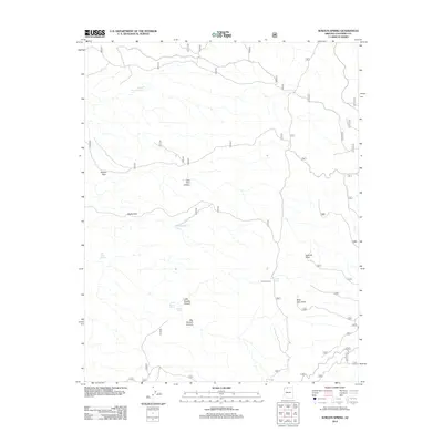
2012 Map of Sowats Spring
USGS Topo · Published 2012About this map
Sowats Spring and Little Sowats Spring define the hydrological character of this high-plateau landscape, where water sources were critical for early backcountry travel and ranching. The presence of Pine Flat Camp suggests a history of human activity centered around the junction of forest tracks and reliable water at Pine Flat Tank. Navigating this terrain required specific passage through gaps in the topography such as Ranger Pass and Eagle Pass, which provided access between deep drainages. Significant elevation shifts are marked by prominent overlooks at Sawmill Point and West Lake Point, looking down into the dramatic cuts of Big Sowats Canyon and Little Sowats Canyon. The distribution of man-made water features like White Pockets Tank and Bone Hollow Tank illustrates the ongoing management of the arid Coconino County wilderness for grazing and land use in the early 21st century.
Find a feature on this map
14 named features on this map. Tap any name to fly to it.
Don’t see what you’re looking for? This feature index may not catch every label — zoom into the map to look around manually.
Map Details
Editions of this 2012 Sowats Spring Map
This is the sole edition of this map. No revisions or reprints were ever made.
Other maps of this area

1886 · Kaibab
USGS Topo · 1:250,000

1953 · Grand Canyon
USGS Topo · 1:250,000

1957 · Grand Canyon
USGS Topo · 1:250,000

1957 · Jumpup Canyon
USGS Topo · 1:62,500

1958 · Grand Canyon
USGS Topo · 1:250,000

1958 · Big Springs
USGS Topo · 1:62,500

1960 · Grand Canyon
USGS Topo · 1:250,000

1962 · Kanab Point
USGS Topo · 1:62,500
1962 · Powell Plateau
USGS Topo · 1:62,500

1984 · Grand Canyon
USGS Topo · 1:100,000