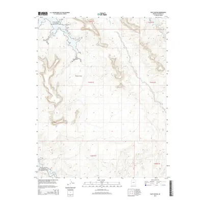
2014 Map of Face Canyon
USGS Topo · Published 2014About this map
Glen Canyon National Recreation Area contains the winding, flooded drainages of the Colorado River system, where the desert landscape meets the high-water marks of Lake Powell. This 2014 topographic study documents the complex shoreline of the reservoir as it reaches into deep sandstone incisions like Face Canyon. The terrain is characterized by the high, flat reaches of the Rainbow Plateau and the prominent rising landforms of Tse Binjoobaahi, showing the stark relief between the plateau surface and the submerged canyon floors. Seasonal watercourses like Sei Billikoon trace the natural drainage patterns that feed into the lake, illustrating the hydrological relationship between the arid uplands and the managed water levels of the Glen Canyon Dam project. The map provides a clear record of the jurisdictional boundaries and the vast, unpopulated character of this Coconino County backcountry in the early 21st century.
Find a feature on this map
12 named features on this map. Tap any name to fly to it.
Don’t see what you’re looking for? This feature index may not catch every label — zoom into the map to look around manually.
Map Details
Editions of this 2014 Face Canyon Map
This is the sole edition of this map. No revisions or reprints were ever made.
Other maps of this area

1886 · Escalante
USGS Topo · 1:250,000

1886 · Echo Cliffs
USGS Topo · 1:250,000

1891 · Echo Cliffs
USGS Topo · 1:250,000

1922 · Warm Creek
USGS Topo · 1:63,360

1953 · Cummings Mesa
USGS Topo · 1:62,500

1953 · Gunsight Butte
USGS Topo · 1:62,500

1954 · Leche-E Rock
USGS Topo · 1:62,500

1954 · Navajo Creek
USGS Topo · 1:62,500

1956 · Escalante
USGS Topo · 1:250,000

1956 · Marble Canyon
USGS Topo · 1:250,000