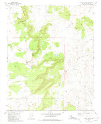
1981 Map of Howard Spring
USGS Topo · Published 1981About this map
Espee Camp serves as a lone human outpost in this high desert landscape of Coconino County, defined by a sophisticated network of water management features essential for ranching and survival. The terrain is marked by numerous named catchments and reservoirs, such as Watson Lake, Horse Lake, and the uniquely named C Lake, which illustrate the critical importance of water rights and livestock grazing in the late twentieth century. Natural drainage is centered on the winding Monument Wash, while Howard Spring provides a rare permanent water source amidst the arid topography. This 1981 survey documents a remote ranching infrastructure through various specialized tanks, including the V L Bar Tank, Duff Brown Tank, and Freeman Tank, each positioned to support movement across this isolated stretch of the Arizona plateau.
Find a feature on this map
13 named features on this map. Tap any name to fly to it.
Don’t see what you’re looking for? This feature index may not catch every label — zoom into the map to look around manually.
Map Details
Editions of this 1981 Howard Spring Map
This is the sole edition of this map. No revisions or reprints were ever made.
Other maps of this area

1886 · Chino
USGS Topo · 1:250,000

1891 · Chino
USGS Topo · 1:250,000

1922 · Williams
USGS Topo · 1:125,000

1948 · Williams
USGS Topo · 1:250,000

1954 · Williams
USGS Topo · 1:250,000

1956 · Williams
USGS Topo · 1:250,000

1960 · Williams
USGS Topo · 1:250,000

1961 · Williams
USGS Topo · 1:250,000
1962 · Hearst Mtn.
USGS Topo · 1:62,500
1973 · Mount Floyd
USGS Topo · 1:24,000