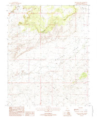
1988 Map of Shinarump Point
USGS Topo · Published 1988About this map
Shinarump Point and the towering Shinarump Cliffs define the northern landscape of this Coconino County terrain as it was documented in the late 1980s. This survey area is characterized by a complex network of drainage systems, including Lost Spring Wash and Johnson Run, which carve through the high plateaus. The presence of several Gravel Pit locations and scattered Prospects suggest localized extraction efforts during this period, while a prominent Trans Line indicates the modernization of the region's utility infrastructure.
Find a feature on this map
15 named features on this map. Tap any name to fly to it.
Don’t see what you’re looking for? This feature index may not catch every label — zoom into the map to look around manually.
Map Details
Editions of this 1988 Shinarump Point Map
This is the sole edition of this map. No revisions or reprints were ever made.
Other maps of this area

1886 · Kanab
USGS Topo · 1:250,000

1886 · Kaibab
USGS Topo · 1:250,000

1953 · Cedar City
USGS Topo · 1:250,000

1953 · Grand Canyon
USGS Topo · 1:250,000

1954 · Johnson SE
USGS Topo · 1:24,000

1954 · Kanab SE
USGS Topo · 1:24,000

1954 · Shinarump NW
USGS Topo · 1:24,000

1954 · Johnson SW
USGS Topo · 1:24,000

1954 · Fredonia NE
USGS Topo · 1:24,000

1954 · Fredonia
USGS Topo · 1:62,500