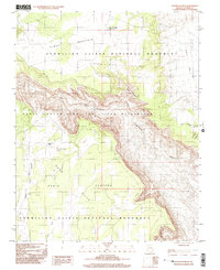
1997 Map of Water Pockets
USGS Topo · Published 2003About this map
Vermilion Cliffs National Monument and the Paria Canyon-Vermilion Cliffs Wilderness dominate this high-desert landscape in northern Arizona. The area is characterized by the dramatic descent from the Paria Plateau into the deeply incised channel of the Paria River. Named features like Water Pockets and Thousand Pockets reveal the vital role of natural water catchment in this arid terrain, where erosion has carved out basins that historically sustained travelers and wildlife.
Find a feature on this map
15 named features on this map. Tap any name to fly to it.
Don’t see what you’re looking for? This feature index may not catch every label — zoom into the map to look around manually.
Map Details
Editions of this 1997 Water Pockets Map
This is the sole edition of this map. No revisions or reprints were ever made.
Other maps of this area

1886 · Escalante
USGS Topo · 1:250,000

1886 · Echo Cliffs
USGS Topo · 1:250,000

1891 · Echo Cliffs
USGS Topo · 1:250,000

1951 · Lees Ferry NE
USGS Topo · 1:24,000

1953 · Nipple Butte
USGS Topo · 1:62,500

1954 · Lees Ferry NW
USGS Topo · 1:24,000

1954 · Paria Plateau SE
USGS Topo · 1:24,000

1954 · Lees Ferry SE
USGS Topo · 1:24,000

1954 · Lees Ferry SW
USGS Topo · 1:24,000

1954 · Lees Ferry
USGS Topo · 1:62,500