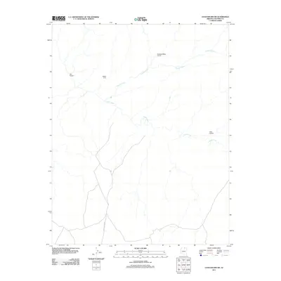
2011 Map of Chaiyahi Rim SW
USGS Topo · Published 2011About this map
Navajo Creek and its complex network of tributaries define this high-desert landscape in Coconino County, where seasonal water flow has carved deep, winding passages through the terrain. The 2011 survey highlights significant geological landmarks like Mikes Arch and the dramatic drop of Trampled Water Canyon. While the area is largely characterized by its natural drainage patterns, the presence of Navajo Canyon Rd provides a singular artery for overland travel through this remote portion of Arizona. Other notable features include Chaiyahi Creek, which flows through the northern reaches of the quadrangle, and the distinct topographical profiles of Jayi Canyon and Long Canyon. This map provides a clear record of the physical geography and established access routes in the region during the early 21st century.
Find a feature on this map
7 named features on this map. Tap any name to fly to it.
Don’t see what you’re looking for? This feature index may not catch every label — zoom into the map to look around manually.
Map Details
Editions of this 2011 Chaiyahi Rim SW Map
This is the sole edition of this map. No revisions or reprints were ever made.
Other maps of this area

1883 · Marsh Pass
USGS Topo · 1:250,000

1886 · Echo Cliffs
USGS Topo · 1:250,000

1891 · Echo Cliffs
USGS Topo · 1:250,000

1892 · Marsh Pass
USGS Topo · 1:250,000

1954 · Navajo Creek
USGS Topo · 1:62,500

1956 · Marble Canyon
USGS Topo · 1:250,000

1959 · Marble Canyon
USGS Topo · 1:250,000

1961 · Marble Canyon
USGS Topo · 1:250,000
1970 · Chaiyahi Rim SW
USGS Topo · 1:24,000
1970 · Two Red Mesas
USGS Topo · 1:24,000