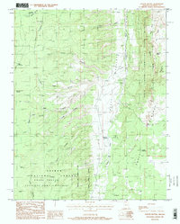
1988 Map of Coyote Buttes
USGS Topo · Published 1988About this map
Vermillion Cliffs Wilderness and the striking formations of Coyote Buttes dominate this 1988 landscape in northern Arizona. The area is defined by intricate drainage patterns and deep geological incisions, including Maries Canyon, Larkum Canyon, and Long Canyon. These features descend into Coyote Valley and eventually the Paria Plateau. Human impact on the land is represented by a series of water management sites necessary for survival in this arid environment, such as Lone Tree Reservoir, Leach Reservoir, and Sheering Corral Reservoir.
Find a feature on this map
37 named features on this map. Tap any name to fly to it.
Don’t see what you’re looking for? This feature index may not catch every label — zoom into the map to look around manually.
Map Details
Editions of this 1988 Coyote Buttes Map
This is the sole edition of this map. No revisions or reprints were ever made.
Other maps of this area

1886 · Kanab
USGS Topo · 1:250,000

1886 · Escalante
USGS Topo · 1:250,000

1886 · Echo Cliffs
USGS Topo · 1:250,000

1886 · Kaibab
USGS Topo · 1:250,000

1891 · Echo Cliffs
USGS Topo · 1:250,000

1953 · Cedar City
USGS Topo · 1:250,000

1953 · Grand Canyon
USGS Topo · 1:250,000

1954 · Buckskin Gulch SE
USGS Topo · 1:24,000

1954 · Buckskin Gulch SW
USGS Topo · 1:24,000

1954 · Paria Plateau NW
USGS Topo · 1:24,000