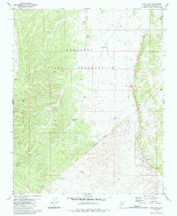
1980 Map of Dike Tank
USGS Topo · Published 1985About this map
The Hualapai Indian Reservation defines this arid landscape in northern Arizona, centered on a series of vital water catchments essential for ranching and survival in the high desert. Scattered across the terrain are several identified storage points, including Sage Tank, Buck Tank, and the titular Dike Tank. The presence of these tanks, along with a Water Tank and Hog Ranch Tank, highlights the complex water management required to support life and livestock away from major river systems. Beyond these functional sites, the map records remnants of earlier human presence with a label for Ruins near the eastern reservation boundary. The topography is shaped by the drainage of Albers Wash, which cuts through the western portion of the quadrangle. An Indian Reservation Boundary runs diagonally through the southern sections, marking the transition from tribal lands to adjacent territories.
Find a feature on this map
12 named features on this map. Tap any name to fly to it.
Don’t see what you’re looking for? This feature index may not catch every label — zoom into the map to look around manually.
Map Details
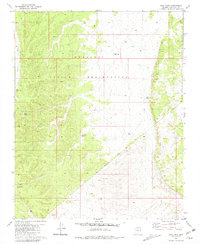
Editions of this 1980 Dike Tank Map
2 editions found
Other maps of this area

1886 · Diamond Creek
USGS Topo · 1:250,000

1886 · Chino
USGS Topo · 1:250,000

1891 · Chino
USGS Topo · 1:250,000

1892 · Diamond Creek
USGS Topo · 1:250,000

1948 · Williams
USGS Topo · 1:250,000

1954 · Williams
USGS Topo · 1:250,000

1956 · Williams
USGS Topo · 1:250,000

1960 · Williams
USGS Topo · 1:250,000

1961 · Williams
USGS Topo · 1:250,000
1967 · Frazier Wells
USGS Topo · 1:24,000