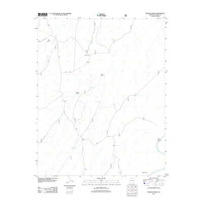
2012 Map of Buffalo Ranch
USGS Topo · Published 2012About this map
Buffalo Ranch serves as a remote focal point for this arid high-desert landscape in northern Arizona, where a sparse network of Forest Service roads provides the only access through a terrain defined by deep canyon systems. The eastern edge of the quadrangle is dominated by the steep descent toward the Colorado River, featuring the dramatic geological formations of Buck Farm Canyon and the Triple Alcoves. This 2012 survey illustrates the critical role of water management in this environment, marking numerous livestock or wildlife watering points such as Navajo Tank, Burro Tank, and Tank Number Eight. Long, winding drainage systems like N Canyon Wash and Tater Canyon carve through the plateau, dictating the route of the Buffalo Ranch Rd and various backcountry tracks. The map's layout highlights the isolation of this ranching and game territory, where infrastructure is limited to essential water tanks and primitive roads like E Side Game Rd.
Find a feature on this map
21 named features on this map. Tap any name to fly to it.
Don’t see what you’re looking for? This feature index may not catch every label — zoom into the map to look around manually.
Map Details
Editions of this 2012 Buffalo Ranch Map
This is the sole edition of this map. No revisions or reprints were ever made.
Other maps of this area

1886 · Echo Cliffs
USGS Topo · 1:250,000

1886 · Kaibab
USGS Topo · 1:250,000

1891 · Echo Cliffs
USGS Topo · 1:250,000

1936 · Jacobs Lake
USGS Topo · 1:48,000

1940 · Jacob Lake
USGS Topo · 1:62,500

1953 · Jacobs Lake
USGS Topo · 1:62,500

1953 · Grand Canyon
USGS Topo · 1:250,000

1954 · Nankoweap
USGS Topo · 1:62,500

1954 · Emmett Wash
USGS Topo · 1:62,500

1956 · Marble Canyon
USGS Topo · 1:250,000