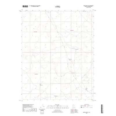
2018 Map of White Sage Flat
USGS Topo · Published 2018About this map
Ryan Rd serves as the primary artery through this high-plateau landscape, cutting across the Coconino County terrain to connect scattered water resources. The area is defined by its series of earthen water catchments, including Cedar Ridge Reservoir, Whiting Tank, and Jensen Tank, which reflect the essential infrastructure required for ranching and wildlife in this arid environment. The topography is marked by distinct rises like Cedar Knoll and Little Cedar Knoll, which overlook the dramatic drops of Wildcat Canyon and Jacob Canyon. Near the southern portion of the quadrangle, the namesake White Sage Flat provides a relatively level expanse amidst the rugged drainage systems of Pigeon Canyon. This layout illustrates a land management pattern focused on water security and livestock movements along established transit corridors.
Find a feature on this map
16 named features on this map. Tap any name to fly to it.
Don’t see what you’re looking for? This feature index may not catch every label — zoom into the map to look around manually.
Map Details
Editions of this 2018 White Sage Flat Map
This is the sole edition of this map. No revisions or reprints were ever made.
Other maps of this area

1886 · Kaibab
USGS Topo · 1:250,000

1953 · Grand Canyon
USGS Topo · 1:250,000

1954 · Shinarump NW
USGS Topo · 1:24,000

1954 · Fredonia NE
USGS Topo · 1:24,000

1954 · Fredonia
USGS Topo · 1:62,500

1957 · Grand Canyon
USGS Topo · 1:250,000
1957 · Shinarump NE
USGS Topo · 1:24,000

1957 · Shinarump SE
USGS Topo · 1:24,000

1957 · Shinarump SW
USGS Topo · 1:24,000
1957 · Shinarump
USGS Topo · 1:62,500