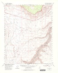
1954 Map of Emmett Wash
USGS Topo · Published 1983About this map
The Vermilion Cliffs dominate this 1954 landscape, forming a massive escarpment between the Paria Plateau and the floor of House Rock Valley. This region of Coconino County is defined by its verticality and the challenges of water management in a desert environment, evidenced by isolated ranching outposts such as Anderson Ranch, Bean Hole Ranch, and the House Kram Ranch. Along the eastern edge of the survey, the Colorado River carves through Marble Canyon, marked by a series of treacherous water features including Hansbrough-Richard Rapids and Cave Springs Rapids. The mapping of cattle-rearing infrastructure like Buffalo Tanks and the Buffalo Range suggests the mid-century reliance on open grazing. Travelers and locals relied on established springs and pools, notably Jacob Pools and Emmett Spr, which served as vital landmarks in an otherwise dry and formidable terrain.
Find a feature on this map
43 named features on this map. Tap any name to fly to it.
Don’t see what you’re looking for? This feature index may not catch every label — zoom into the map to look around manually.
Map Details
Editions of this 1954 Emmett Wash Map
4 editions found

Other maps of this area

1886 · Echo Cliffs
USGS Topo · 1:250,000

1886 · Kaibab
USGS Topo · 1:250,000

1891 · Echo Cliffs
USGS Topo · 1:250,000

1936 · Jacobs Lake
USGS Topo · 1:48,000

1940 · Jacob Lake
USGS Topo · 1:62,500

1953 · Jacobs Lake
USGS Topo · 1:62,500

1953 · Grand Canyon
USGS Topo · 1:250,000

1954 · Emmett Wash NE
USGS Topo · 1:24,000

1954 · Emmett Wash NW
USGS Topo · 1:24,000

1954 · Paria Plateau SE
USGS Topo · 1:24,000