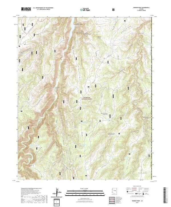
2021 Map of Weimer Point
USGS Topo · Published 2021About this map
Sitgreaves National Forest defines this high-elevation landscape atop the Mogollon Plateau, where a complex system of ridges and canyons drains northward into Chevelon Canyon. The terrain is characterized by dramatic elevation changes at Weimer Point and Possum Point, while family and locally-named landmarks such as Slim Jim Ridge, Larson Ridge, and Saint Joe Ridge provide a sense of the area's historical land use and travel corridors. This land is heavily marked by a network of water management features including Section Tank, Houck Tank, and Potato Tank, essential for sustaining life and livestock in this environment. The presence of specialized recreation routes like the Long Draw Ohv Loop Trl and Ridge Trl alongside older geographic names like Reed Spring illustrates the dual history of this Coconino County backcountry as both a working landscape and a modern recreational destination.
Find a feature on this map
68 named features on this map. Tap any name to fly to it.
Don’t see what you’re looking for? This feature index may not catch every label — zoom into the map to look around manually.
Map Details
Editions of this 2021 Weimer Point Map
This is the sole edition of this map. No revisions or reprints were ever made.
Other maps of this area

1886 · Holbrook
USGS Topo · 1:250,000

1893 · Holbrook
USGS Topo · 1:250,000

1954 · Holbrook
USGS Topo · 1:250,000

1957 · Holbrook
USGS Topo · 1:250,000

1958 · Holbrook
USGS Topo · 1:250,000

1960 · Holbrook
USGS Topo · 1:250,000

1961 · Woods Canyon
USGS Topo · 1:62,500

1961 · Heber
USGS Topo · 1:62,500
1965 · Grama Draw
USGS Topo · 1:24,000

1965 · Chevelon Crossing
USGS Topo · 1:24,000